
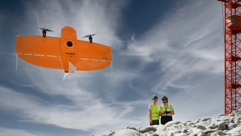
The construction industry, once defined by heavy machinery and manual labor, is now looking to the sky to solve its most grounded challenges. At the forefront of this transformation is drone technology — unmanned aerial vehicles (UAVs) have become essential tools for jobsites today. This guide explores construction drone technology and its practical applications for contractors.
What Are Construction Drone Solutions?
Construction drone solutions are end-to-end systems that combine UAVs, specialized sensors and data-processing software to digitize and optimize jobsite operations. While a standard consumer drone captures a nice picture, a professional construction drone acts as a flying sensor platform. These systems are designed to capture high-resolution, georeferenced data that can be converted into measurable 3D models.
From Photos to 3D Models: How Drone Surveying Works
Understanding the mechanics of a drone construction site survey is key to trusting the data it produces. The process is rooted in a science called photogrammetry.
The Data Acquisition Process
Using specialized flight planning software, the pilot defines a specific boundary. The drone then autonomously flies a precise, preplanned grid pattern. During this flight, the onboard camera captures numerous high-resolution images. Each image is embedded with metadata, including precise Global Positioning System (GPS) or Global Navigation Satellite System (GNSS) coordinates.
From Pixels to Precision
Once the flight is complete, the data is uploaded to a processing engine, such as Trimble Stratus. The software uses sophisticated algorithms to “stitch” these overlapping images together. By identifying common points across multiple photos, the software calculates the exact position of every pixel in 3D space.
Modern surveying drones in construction utilize high-grade hardware, including:
- High-resolution complementary metal oxide semiconductor (CMOS) sensors.
- Real-time kinematic (RTK) or post-processed kinematic (PPK) receivers.
- Light detection and ranging (lidar).
This process yields survey-grade accuracy to within 2-3 centimeters, providing a level of precision that rivals traditional base-and-rover methods in a fraction of the time.
Primary Deliverables
A single drone flight can produce a variety of high-value digital assets, including:
- High-resolution orthomosaic maps: A distortion-free, top-down view of the entire site that serves as a highly detailed visual map.
- 3D point cloud models: A dense collection of millions of data points representing the external surface of the objects or terrain.
- Digital surface models (DSMs) and digital terrain models (DTMs): Vital for understanding elevations, drainage patterns and topographic contours.
High-Value Drone Applications for Your Jobsite
Implementing drone construction surveying provides an immediate return on investment across various phases of a project. Here are the top seven ways drones are used on sites today:
Initial Site Surveys and Topographic Mapping
Traditional topographic surveys can take days or weeks, depending on the terrain. A drone can map a 100-acre site in less than an hour. This speed allows for faster bidding and more comprehensive data collection.
Earthwork and Stockpile Volume Calculations
Measuring stockpiles manually is dangerous and time-consuming. Drones allow you to safely and accurately measure volumes for inventory or track cut-and-fill progress with the click of a button. Managers can generate a volume report in minutes, ensuring they never run out of bedding stone or overpay for dirt removal.
Construction Progress Monitoring
By flying the site weekly or biweekly, you can overlay drone models over time to track progress against the project schedule and design files. This visual record is invaluable for tracking progress and ensuring adherence to project schedules.
As-Built Surveys
Drones quickly capture final site conditions to verify that the project was built as per the specifications. These as-built models provide a permanent digital record of the finished product, which is a major value-add for the client.
Safety Inspections and Site Audits
Drones can inspect hazardous areas, such as high-reach structures, steep slopes or unstable excavations, without putting personnel at risk. This “eye in the sky” helps safety officers identify potential hazards before they lead to an incident.
Quality Assurance
By comparing drone-captured data directly against the original 3D design files, you can catch errors, such as an incorrectly placed utility trench or a foundation offset, early. Catching these mistakes in the digital phase prevents the massive expense of physical rework.
Environmental and Regulatory Compliance
Drones make it easy to monitor erosion control measures and document site conditions for permits. Having a dated, high-resolution visual record ensures you remain compliant with local environmental regulations and can quickly respond to audits.

Get a Bird’s-Eye View of Your Next Project
The benefits of drone surveying for construction are clear, from improved accuracy and efficiency gains to a significantly safer work environment. To make the most of this technology, you need a partner who understands the entire construction workflow.
SITECH Rocky Mountain is your local expert for construction survey drones, software and accessories. We provide the complete end-to-end solution, including industry-leading Trimble software, professional training and local support to ensure your data is accurate and actionable from day one. Our top-notch surveying drones in New Mexico, Colorado and far West Texas help you maintain a competitive edge and ensure project profitability.
Ready to elevate your project management? Contact us today and see how we can help you build smarter.