
SITECH Rocky Mountain is your trusted partner for cutting-edge drone survey solutions. We are proud to offer AeroPoints, the industry’s premier smart ground control points designed to elevate the accuracy and efficiency of your surveying projects with every drone flight.

What are AeroPoints?
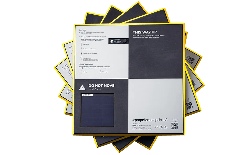
Getting ground control right is essential for consistent, high-quality data in your commercial drone operations. AeroPoints, developed by Propeller Aero, are the world's first smart ground control solution specifically designed for drone operations, simplifying and making accurate data capture affordable. Each AeroPoint is a portable, reusable ground control point (GCP) that records positioning data continuously during your flight. Lightweight and durable with a simple one-touch operation, a standard set of 10 AeroPoints can be positioned around a survey site in just minutes.
1.2M
total AeroPoint captures
5,000+
compatible coordinate systems
8.46mm
average AP accuracy

Key Features
- Total Accuracy Solution: Seamlessly use AeroPoints as ground control, checkpoints, and base stations for all your survey needs.
- One-Button Operation: With a simple press of a button, no expertise is required. Just place the AeroPoints and press to start recording position data instantly.
- Simplified GPS Recording: Featuring dual-frequency (L1/L2) GPS, AeroPoints record positioning data every five seconds, ensuring precise data capture.
- Enhanced Data with PPK: Pair AeroPoints with a Propeller-recommended drone for a complete PPK workflow. They serve as a base station for automatic corrections, maximizing data accuracy.
- Flexible Power Options: Charge AeroPoints using solar power or plug them in for a quick recharge, offering versatile charging options.
- Ample Data Storage: Store data from over 100 flights before an upload is necessary, thanks to AeroPoints' substantial memory capacity.
- Mobile App Functionality: Download the AeroPoints App for real-time diagnostics and quick setup, making field operations smoother.
- Built-In WiFi Connectivity: Automatically upload your GPS data from the field with built-in WiFi, eliminating the need for CSV files.
- Automatic Data Corrections: Access our global base station network for automatic data corrections, ensuring high precision without manual intervention.
- Robust Design: AeroPoints feature a high-visibility, water-resistant outer shell, designed to withstand tough environments and ensure durability.
AeroPoints + Trimble Stratus
AeroPoints seamlessly integrate with Trimble Stratus to enhance your survey workflows. AeroPoints data is easily uploaded and processed through Trimble Stratus, a cloud-based platform that provides comprehensive geospatial data management and analysis. The combination of AeroPoints and Trimble Stratus ensures high accuracy in mapping and surveying projects, automating the data correction process and eliminating the need for manual inputs. This powerful integration streamlines workflows, reduces errors, and efficiently delivers reliable, survey-grade results for both new and existing Trimble customers, who can now enjoy a seamless drone data workflow.

Discover Propeller Aeropoints
Contact Us Today
Ready to take your surveying to the next level with AeroPoints? Contact SITECH Rocky Mountain today to learn more about how AeroPoints can revolutionize your workflow and enhance the precision of your survey data.